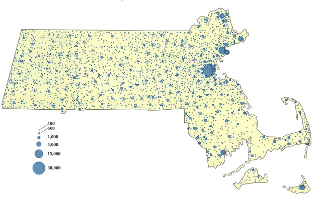
Massachusetts, 1810
A map showing the population distribution of Massachusetts based on the 1810 Federal census. It shows how remarkably and evenly distributed people were across the entire breadth of the state prior to industrialization.
The US Census of 1810 counted 421,040 inhabitants, with 79% of them dispersed in rural areas or in villages of under 2,500 people. Counties with the largest populations were Essex (71,888), Worcester (64,910), and Middlesex (52,789). The four western counties had a quarter of the population of the state (112,182), the greatest proportion that region ever achieved. The largest citIes were Boston—33,250 (4th in US), Salem—12,613 (7th in US), Newburyport—7,634 (12th in US), and Nantucket—6,807 (14th in US). In 1810, one in 15 Americans lived in Massachusetts.
Wilkie, Richard W. and Tager, Jack. “Historical Atlas of Massachusetts”. University of Massachusetts Press, 1991.


Fascinating! Now show us the map in 1910 and 2010.
» Posted by Anonymous on February 5, 2013 09:22 AM