State Border Anomalies
A collection of small, odd state boundary features. The maps below are linked to the specific area on Google Maps to get a wider perspective. Links to the town names generally discuss why the particular feature exists, but for the most part they are the result of survey lines meeting geographical features in unanticipated ways.
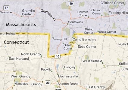
The town of Southwick, Massachusetts extends two and a half miles into Connecticut along the boundary establish in 1804:
A small western portion of Virginia cuts back eastward into West Virginia. There is even a smaller bulb extending off that with a neck only 200 feet wide near the unincorporated community of Wyoming City:
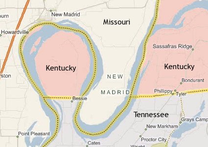
The far western portion of Kentucky contains a polyp extending off Tennessee around a segment of the Mississippi River known as The Kentucky Bend:
The village of Beecher Falls, part of the town of Canaan, Vermont, juts like a dagger into the northern reaches of New Hampshire. This is perhaps my favorite one because of all the time I’ve spent looking at maps of this region, I never even noticed this until a couple of years ago:
Gnarly.


So did you find all these yourself?
As a kid, I liked “geography puzzles” such as: Which is further west, Reno or Los Angeles?
» Posted by Berns on October 23, 2007 08:51 PM